
Nowry & Hale Land Surveying LLC
192 N Main, Suite D
Plymouth, MI 48170
Phone: 734-446-5501
Email: nowryhale1@yahoo.com.com


© 2012 Nowry & Hale Land Surveying. All Rights Reseved
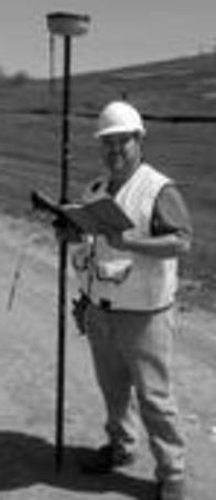
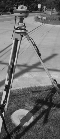
At Nowry & Hale Land Surveying LLC, we take care to provide our customers with high quality professional Land Surveying personalized for their unique surveying needs. We offer a full spectrum of land surveying services for all of Southeast Michigan. Below is an explanation of some of the services provided by our surveyors in Michigan.
FEMA Flood Elevation Certificates/LOMA Surveys
Federal Emergency Management Agency (F.E.M.A.) Flood Elevation Certificates and L.O.M.A. Applications for residential and commercial properties. We perform the necessary survey work to determine whether or not your structure is above or below the base flood elevation at that geographical location. We then use that data to complete the certificate showing the results of the flood elevation survey. If the results of the flood elevation survey show that you are above the base flood elevation, as Licensed Professional Surveyors we can complete an E-LOMA and usually have the results within 24 hours. (AE Zone only) This would provide a document from FEMA which states that the structure has been removed from the flood zone.
ALTA/ACSM SURVEYS
If you are purchasing a commercial, industrial or multi family residential property and obtaining a title insurance policy, you may be required to have an American Land Title Association Survey (ALTA) performed to better evaluate risks associated with that property.
The American Land Title Association (ALTA) and the American Congress of Surveying and Mapping (ACSM) have provided minimum standard requirements for ALTA/ACSM Land Title Surveys which we utilize in preparation of these documents.
PROPERTY BOUNDARY SURVEYS
(Residential/Commercial/Municipal)
This type of survey is the most fundamental service our land surveyors in Michigan offer. These are sometimes referred to as property line surveys or stake surveys. Essentially people who want a boundary survey performed do so because they need to know where their property lines and corners are for some reason. Whether you are planning an improvement near a property line, putting up a fence, or having a property line dispute with a neighbor, you need to know exactly where the property line locations are.
Nowry & Hale Land Surveying LLC will ensure an accurate Survey that we are willing to defend in court if needed. Even if your community does not require a survey for your project, it is very important to know your boundaries to avoid future problems with neighbors or with the city.
If you order a boundary survey, Nowry & Hale will mark out where the deeded property corners are with capped iron rods witnessed with a wood stake and flagging. We then provide the client with a Certificate of Survey drawing showing the results of the survey. The certified drawing is a legal document which can be used as evidence in a court of law
SITE PLAN/PLOT PLAN
A Site Plan is a drawing or map, which is required by a municipality for approval of a planned construction project. A Site Plan may include information about elevations, setbacks, adjacent structures, location and dimensions of proposed construction, and/or utility services information. Requirements vary widely among municipalities, a TOPO and Boundary Surveys are usually required as well.
CONSTRUCTION STAKING
The first activity that happens on any new construction site is the staking. Nowry & Hale Land Surveying LLC can locate with wood stakes locations and elevations for anything on your approved set of plans. If you want the job done right the first time ask us to help you with your construction staking needs. You can be assured that a licensed professional will perform all of your work providing you with the highest quality possible. We are licensed and fully insured for ours and your protection.
PROPERTY SPLITS/COMBINATIONS
If you want to split or combine a parcel of land with another you will need a survey to submit to your municipality. We at Nowry and Hale Land Surveying are experienced with this type of project and can help you every step of the way. With our knowledge of various state and municipal laws and regulations we can ensure that you execute your plan efficiently and within in the law to guarantee a smooth process.
Typical examples of this type of project involve the dividing of a large tract of land into smaller tracts to sell and splitting off a piece of an existing property to a neighbor or family member. Whatever your plan is, you will need a Professional Surveyor to help and consult you along the way.
TOPOGRAPHIC SURVEYS
Topographic design surveys involve mapping all site features and improvements to determine drainage and feasibility of a proposed commercial, public or residential development. It may consist of a single lot where a client wants to build a house or a parcel 100 acres in size where a developer wants to build a subdivision or shopping center. Nowry & Hale Land Surveying can prepare a detailed map of the existing site to aid in a correctly designed project.
MORTGAGE SURVEYS
Also called: Mortgage Inspection, Mortgage Report, Mortgage Survey...
A Mortgage Survey is a simple survey that generally determines land boundaries and building locations. Mortgage Survey is usually required by title insurance companies and lending institutions when providing financing. Certificate shows that there are no structures encroaching onto the property, and that the position of structures is generally within zoning and building code requirements.
A Mortgage Certificate (Survey) is not a Boundary Survey or Property Line Survey and it shall not be used to establish property lines, easements, etc. Property markers are not set.
AS-BUILT SURVEYS
An As-Built Survey is a post-construction Survey verifying that construction has been completed according to the approved design plans. This Survey is usually required when seeking an occupancy permit.
HAZARDOUS SITE & ENVIRONMENTAL SURVEYS
Nowry & Hale Land Surveying offers services to environmental clients including work on environmentally hazardous sites. Both Al & Mike are 40 hour HAZWOPER trained and regularly perform work requiring additional safety training. Services include stakeout of hazardous areas, topographic surveys for volume calculations for hauled material, surveys for restrictive covenants and areas of release, well surveys, soil boring locations and data for points provided in State Plane/ NAVD88 datums per state requirements.
Copyright 2012: Nowry & Hale Land Surveying LLC | Surveyors Michigan |
All rights reserved. 192 N Main, Suite D, Plymouth, MI 48170 734-446-5501